| Private and public land |
|
|---|---|
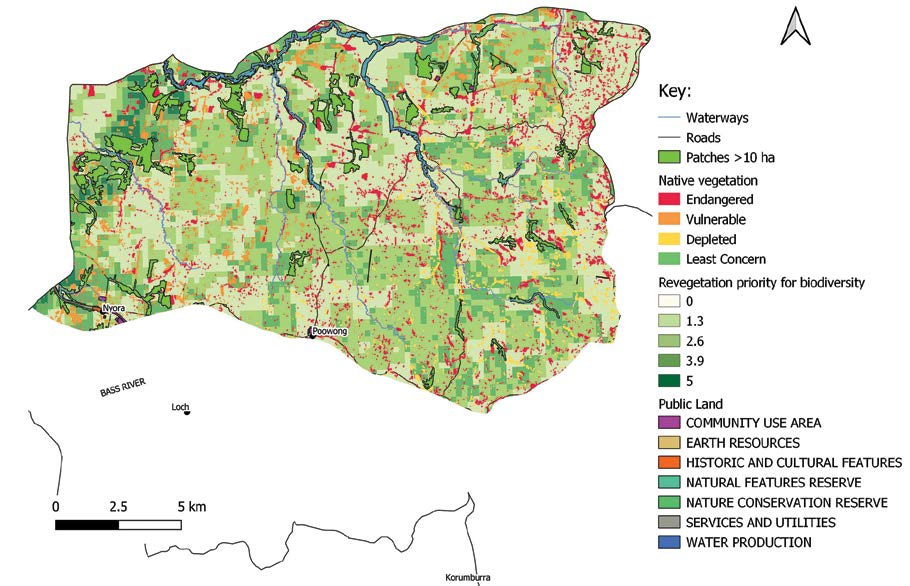
| Habitat priorities | 1728 ha of native vegetation patches > 10 ha, mainly located within the northern and western portions of the landscape zone. Areas of high revegetation priority are most prevalent in the western portion of the zone north of Nyora, linking larger patches of remnant vegetation and waterways. |
| Key threatened species | Gang-gang cockatoo, little eagle, Narracan corrugated mussel, giant Gippsland earthworm, platypus, Narracan burrowing crayfish, black falcon, blue-winged parrot, barking owl, powerful owl, southern toadlet. Strzelecki gum, green scentbark. |
| Key threats |
|
Source: South Gippsland Biodiversity Protection Plan (October 2024), section 3.8 Biodiversity values by local area or landscape zone. See the nine Strategic Directions for the plan’s objectives, actions and measures.