| Private and public land |
|
|---|---|
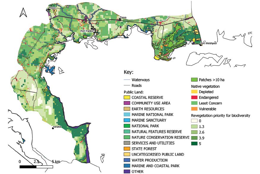
| Habitat priorities | 2245 ha of native vegetation patches > 10 ha, mainly located between Barry Beach and Welshpool as well as in locations around the coast. Areas of the highest revegetation priority are to the west of Port Welshpool, linking larger patches of vegetation to remnants around the town, also along the western shoreline of Corner Inlet, at Yanakie and through to Wilsons Promontory. |
| Key threatened species | Gang-gang cockatoo, blue-winged parrot, powerful owl, white-bellied sea-eagle, caspian and fairy tern. Migratory shorebirds and waterbirds such as eastern great, plumed and little egrets, hardhead, Lewin’s rail. Strzelecki burrowing crayfish, South Gippsland spiny crayfish, dwarf galaxias, Cox’s gudgeon, Australian grayling, yellow-bellied glider, southern toadlet, lace monitor, platypus. Grey mangrove, slender tree-fern, southern blue gum, Strzelecki gum, bog gum, threatened orchids. |
| Key threats |
|
Source: South Gippsland Biodiversity Protection Plan (October 2024), section 3.8 Biodiversity values by local area or landscape zone. See the nine Strategic Directions for the plan’s objectives, actions and measures.